“Extremely Dangerous” Winter Storm Could Bring 10+ Inches of Snow to These Areas

The weather this winter has been confusing, to say the least. Thanks to arctic blasts to spring-like temperatures in January, we haven’t really been sure what to expect with each passing week. But while we may have been hoping to veer toward warmer temperatures with March’s arrival, that’s not going to be the case for some parts of the country. Read on to find out where an “extremely dangerous” winter storm could bring 10 or more inches of snow.
RELATED: Meteorologists Warn That “Super El Niño” Could Lead to Intense Hurricane Season.
California will be hit the hardest.
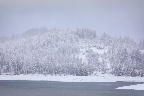
Several feet of snow, hurricane-strength winds, and blizzard conditions are on the docket for California this weekend, The Washington Post reported. This is already the second day of the storm, which kicked off yesterday, Feb. 29.
In a March 1 winter weather message, the National Weather Service (NWS) in Sacramento, California warned that snow accumulations could reach 12 feet or more in the highest elevations and wind gusts could be 75 mph or higher.
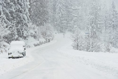
With that in mind, experts advised against travel through the Sierra Nevada mountain range, as near zero visibility and whiteout conditions will make travel “extremely dangerous to impossible,” the NWS in Sacramento said.
“We have been saying all week that the time to hunker down is upon us,” the NWS in Reno, Nevada, added in an area forecast discussion this morning.
RELATED: “Extended Winter” May Keep Things Cold in These Regions, Meteorologists Predict.
Yosemite National Park was forced to close.
As of Friday morning, wind gusts were up to 100 mph at mountain peaks, and conditions have already shuttered Yosemite National Park in California.
“Yosemite National Park will be closed starting tonight at midnight due to a major winter storm,” the park service wrote in a Feb. 29 Instagram post. Visitors in the park were urged to “leave as soon as possible,” with the park staying closed through Sunday, March 3, at noon, if not longer.
“The National Weather Service is forecasting several feet of snow throughout the park (Badger Pass may receive over seven feet!) with very high winds,” the park service added.
Other states will see blizzard conditions, too.
California isn’t the only state dealing with this winter storm. The NWS issued alerts for seven other Western states: Idaho, Montana, Nevada, Oregon, Utah, Washington, and Wyoming, Newsweek reported.
Nine inches of snow and wind gusts up to 45 mph are expected in the Cascades of western Washington and Oregon, and in the southern Cascades of Oregon, snow totals may reach three feet, according to Newsweek. Per a graphic published by CNN using NWS data, up to 10 inches of snow may accumulate in parts of Wyoming, Colorado, Utah, and Montana, as well.
In the western portion of Nevada, residents may also see up to a foot of snow, according to Fox Weather.
“Because the winds are so strong, rather than just hitting the windward or western side of the mountains, the snow is being carried across the entire [Sierra Nevada] mountain range,” Fox Weather Winter Storm Specialist Tom Niziol said. “So we’re going to see heavy snowfall amounts even into a good part of Nevada.”
RELATED: Widespread Blackouts Predicted for 2024—Will They Hit Your Region?
When will the storm be over?

According to The Washington Post, Friday night will bring the heaviest snow in parts of California, with two to four inches or more accumulating every hour, as well as potential thunder. Snow will continue through the weekend, “easing modestly on Sunday,” the outlet reported.
While winds are anticipated to “relax” in the valleys by Monday and “settle to breezes” in the ridges by the middle of next week, snow is another story, the NWS in Reno said.
“This storm will be taking its time on the exit,” experts wrote in the area forecast discussion. Snow showers could linger even into midweek, as “winter is insisting on extending this stay a while.”