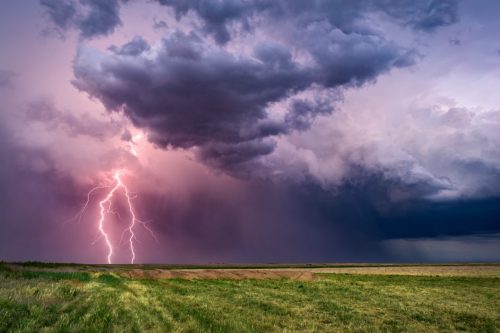
“Ring of Fire” Thunderstorms Could Flood These Regions As Extreme Weather Week Begins

We all know to expect the blazing heat and rising temperatures when summer rolls around. But what about a ring of fire? Although not a formal weather term, “ring of fire” is what some meteorologists use to describe a type of weather pattern that occasionally arrives during the summertime, according to The Weather Channel. This pattern involves moisture circling around the periphery of a dome of high pressure, simultaneously bringing both extreme heat and thunderstorms. Now, experts say flooding could be in the cards, as a ring of fire is expected to hit the U.S. this week. Read on to find out what’s in store during a week of unusual weather for the country.
RELATED: Forecasters Predict 23 Named Storms This Season, Including 11 Hurricanes.
A heat dome is headed for the Eastern states.

Record high temperatures are expected to hit several cities this week due to a heat dome developing over the eastern U.S., The Weather Channel reported. The heat is expected to spread from the southern Great Lakes and Ohio Valley into the Northeast during the first half of the week, resulting in cities like Detroit, Cincinnati, Cleveland, Pittsburgh, Philadelphia, Boston, and Hartford reaching daily record highs from today through Saturday.
In a June 16 post on X, the National Weather Service’s (NWS) Weather Prediction Center (WPC) warned that this will be the “first significant heat wave this season,” with the potential for some places in this region to hit 105 degrees Fahrenheit.
“The duration of this heat wave is notable and potentially the longest experienced in decades for some locations,” the WPC wrote in its post.
RELATED: Record-Shattering Hot Summer Predicted for These Parts of the U.S.
Thunderstorms are expected to hit the Midwest.

While the eastern part of the U.S. sizzles under a heat dome this week, rounds of heavy rain and severe storms are expected to move along the edge to create that “ring of fire” weather pattern, Fox Weather reported. The thunderstorms will start hitting the Midwest today.
“Scattered strong to severe storms should occur today across parts of the Upper Mississippi Valley, and over the central High Plains and northern Plains late this afternoon through tonight,” the NWS’s Storm Prediction Center (SPC) states in a warning on its website. “Both severe/damaging winds and large hail appear possible.”
Nearly 7 million people from Minneapolis, Minnesota, to Fargo, North Dakota, have been placed under a “slight risk of severe thunderstorms” for Monday, June 17, according to the NWS SPC. This is a Level 2 out of 5 risk on the SPC’s severe thunderstorm risk scale.
RELATED: “La Nada” Will Impact Summer Heat and Severe Weather—What to Expect in Your Region.
Some regions are at risk of flooding, too.

These thunderstorms could cause more extreme weather events as well. Due to the moderate risk of excessive rainfall in parts of the Upper Midwest on Monday, the WPC warned in a June 16 X post that “heavy rain and saturated soils [could] overlap to create chances for numerous flash floods.”
Today, parts of northeastern South Dakota, southeastern North Dakota, and much of central and northern Minnesota are at a Level 3 out of 4 risk of flash flooding, Fox Weather reported. This flash flood threat will decrease to a Level 2 on Tuesday, but expand to include more regions in parts of Nebraska, Kansas, and Oklahoma, according to the news outlet.
Then, on Wednesday, the WPC has placed a wider area of the Plains and Midwest under a flash flood threat. Most of Iowa and Wisconsin, as well as part of Colorado and Missouri, will join the other states, but the risk will drop to a Level 1, per Fox Weather.
One region of the U.S. could see snow this week.

A heat dome, thunderstorms, and flooding are enough to call this an extreme weather week. But something even stranger is happening in the U.S. this week. Some parts of the northern Rocky Mountains are also expected to see much lower-than-average temperatures over the next few days, USA Today reported.
“They’re going to see some nights coming down into the 20s and low 30s, and up in the northern Rockies they’ll be getting some snow,” Tom Kines, a meteorologist with Accuweather, told the newspaper.
The snow isn’t likely to impact many populated areas, because it’s expected to fall at higher elevations above 6,000 feet, according to Kines.
“But nevertheless, it’s June now and we’re talking about snow,” he said.