8 States at Risk of Dayslong Severe Weather, Starting Tomorrow

Let’s hope April showers actually do bring May flowers—especially because millions of people across the U.S. are expected to get hit with multiple days worth of thunderstorms during the latter half of this week, according to Fox Weather. The brunt of this dayslong severe weather event is expected to begin on Thursday, April 25, but may start as early as tomorrow. By Friday, the risk zone for the severe storm threat is expected to expand to include at least eight states: Nebraska, Kansas, Oklahoma, Texas, Missouri, Iowa, Arkansas, and Illinois.
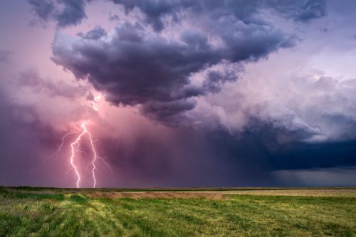
“Multiple rounds of severe thunderstorms could produce large hail, wind damage and tornadoes in the central United States beginning late this week as a classic springtime jet stream pattern sets up,” senior meteorologist Chris Dolce reported for The Weather Channel.
To find out more about how this dayslong severe weather is expected to progress throughout these eight states from Thursday to Sunday, read on.
RELATED: 2024 Hurricane Season May Be 170% More Active—The States Most at Risk.
Thursday
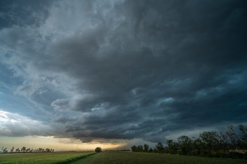
The main concern for Thursday is in the southern and central Plains. The National Weather Service’s (NWS) Storm Prediction Center indicates that severe thunderstorms may develop in this area late Thursday afternoon and into Thursday night.
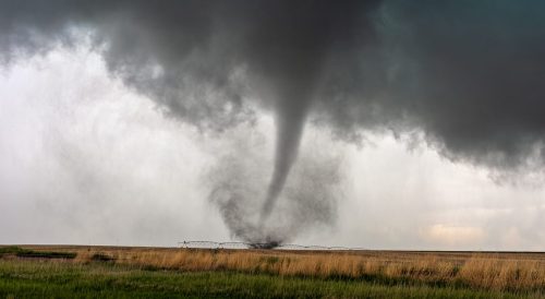
“Large hail, severe wind gusts, and a few tornadoes will all be possible,” the NWS warns, rating that region as a Level 2 out of 5 on its 5-point severe thunderstorm risk scale.
Fox Weather adds that the severe weather threat is expected to extend from south-central Nebraska through central Kansas, western and central Oklahoma, and northwestern Texas.
Friday

On Friday, the risk of severe weather will start to shift somewhat east, bringing an “unstable environment extending from the southern/central Great Plains into parts of the Midwest and Mississippi Valley,” according to the NWS.
This will extend the region into which “severe storms capable of producing large hail, damaging winds, and a few tornadoes will be possible,” the NWS says.
Fox Weather reports that all eight states from Texas to Iowa will be in a Level 2 out of 5 risk on Friday, impacting major cities such as Dallas, Waco, Oklahoma City, Tulsa, Springfield, and Des Moines.
RELATED: Widespread Blackouts Predicted for 2024—Will They Hit Your Region?
Saturday
If you thought trouble would be over for the central and southern Plains region by this weekend, think again. “Another strong shortwave trough is forecast to eject across parts [of this region] Saturday afternoon and evening,” the NWS explains.
The mid-Mississippi Valley region isn’t safe on Saturday either, as the NWS says “some severe threat could spread toward parts” of this region later in the day.
Sunday
The NWS says that “predictability begins to decrease by late in the weekend,” but their experts still expect that a storm system will move from the central Plains towards the upper Great Lakes region on Sunday.
“A corridor of severe thunderstorm potential is forecast to extend south-southwestward from the surface low, as a trailing cold front moves through a moist, unstable, and favorably sheared environment,” the agency warns.