Early Spring Storms Will Bring Tornadoes and Hail to These Regions
The transition from winter to spring is often an exciting time where we begin to welcome warmer temperatures and longer, sunnier days. But even if spring usually means an end to blizzards and other harsh conditions, it can still usher in some destructive weather along with it. Now, meteorologists say early spring storms will bring tornadoes and hail to some areas within the next week. Read on to see which regions could be affected as the season begins.
RELATED: First Spring Storm Could Bring 8+ Inches of Snow to These Regions.
Spring is kicking off with snowy and chilly conditions in some parts of the U.S.
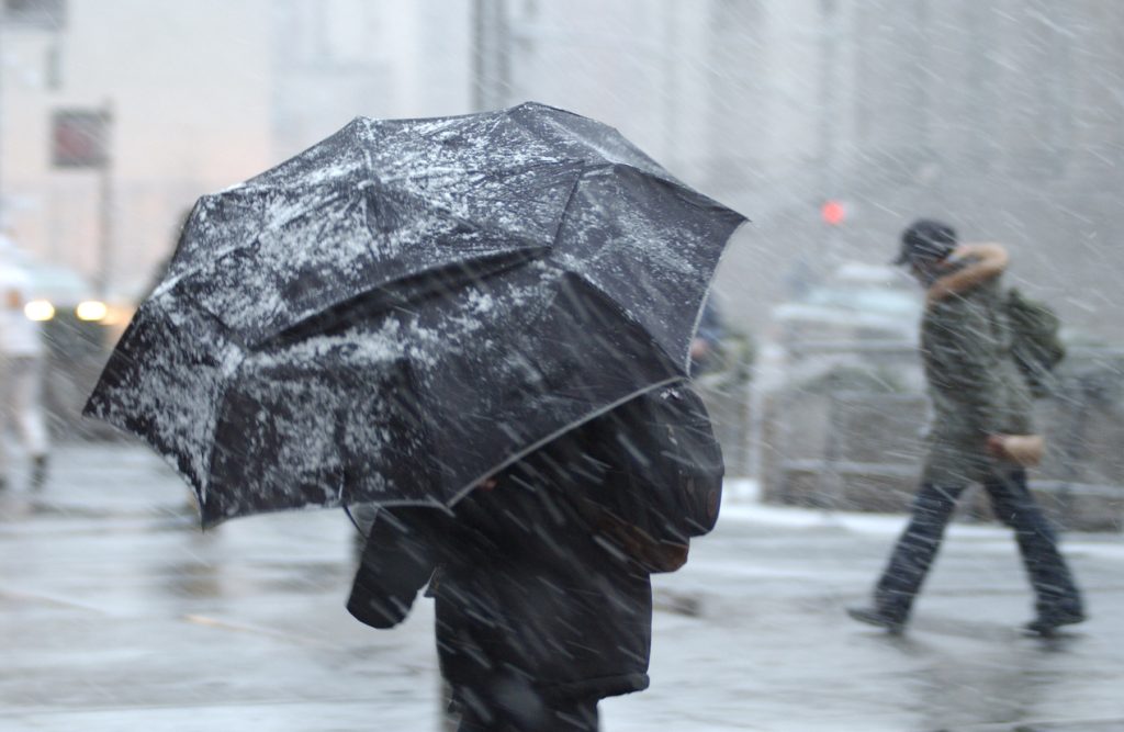
Even though the calendar says it’s officially spring, many people may not be feeling the changes quite yet. After an unseasonably chilly start to the week for the Southeast, parts of the Midwest are now bracing for a storm that’s expected to bring considerable snowfall.
Colder air pushing down from Canada is combining with moisture from warmer southern air masses to create the system, Fox Weather reports. Snow is expected to start falling in the Rockies and eastern Montana today before pushing east into North and South Dakota, Wisconsin, Michigan, and northern Illinois by tomorrow.
Forecasts predict that cities like Minneapolis, Green Bay, and Milwaukee could be the hardest hit with snow, with five to eight inches of accumulation through Friday. The system is then expected to pass into the Northeast, where it could drop more snow just as the weekend begins.
RELATED: “Extended Winter” May Keep Things Cold in These Regions, Meteorologists Predict.
A new storm system could bring severe weather early next week.
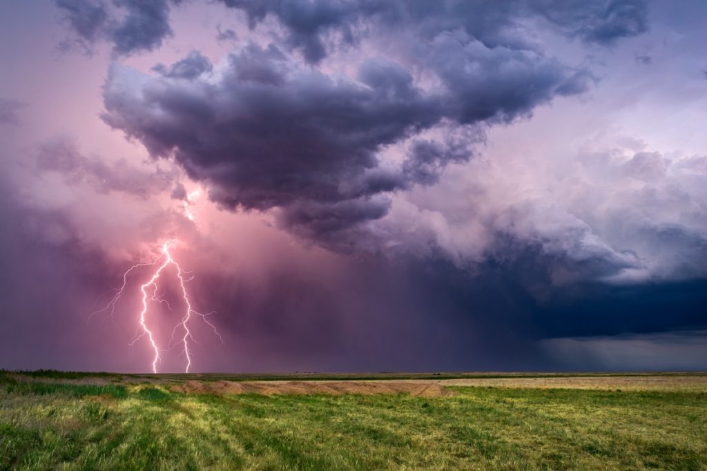
While the lingering winter conditions might feel harsh now, they’re expected to give way to even more dangerous weather soon.
A long-range forecast says a storm system moving in from the Pacific is expected to make landfall in the U.S. by the weekend when it will drop heavy precipitation on parts of the West Coast, AccuWeather reports. Colder areas to the north might see some snowfall early next week as a result, especially from Colorado through Nebraska and South Dakota to Minnesota.
But as it passes the Rocky Mountains, a jet stream is expected to feed it with moist, warm air from the Gulf of Mexico that will fuel heavy rain and thunderstorms in warmer areas to the south.
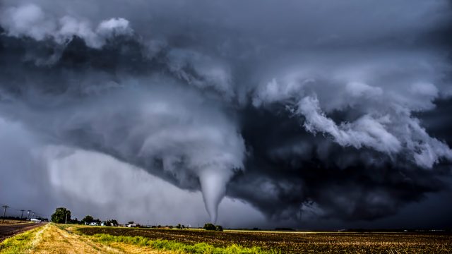
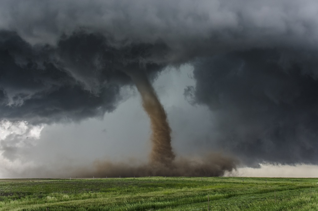
The Southeast could be in for potential tornadoes and large hail.
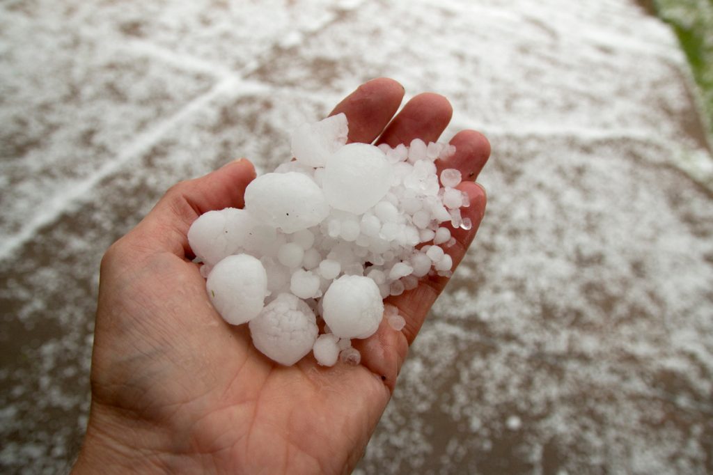
According to the forecast, severe storms could begin to develop in Oklahoma and Texas late this weekend. AccuWeather reports that they’re expected to move farther east into the Mississippi Valley and interior Southeast on March 24 and 25. The forecasted area includes Arkansas, Louisiana, Mississippi, Alabama, Missouri, Tennessee, Georgia, and West Virginia.
Data is too far out to pinpoint precisely where the severe weather could hit. However, the outlook does include the potential for heavy rain and flash flooding, large hail, and even tornadoes.
“The orientation of the jet stream and storm track will determine the nature, location, and scope of the severe weather for the first part of next week,” said Paul Pastelok, a long-range meteorologist with AccuWeather.
RELATED: Signs Now Pointing to an “Explosive Hurricane Season” This Year, Scientists Warn.
Severe weather season is officially starting, but significant events have already occurred.
While severe weather is possible at any time of year, spring also marks the peak of tornado season in parts of the U.S. Conditions begin to ripen in March when warmer, humid air from southern areas smashes up against colder air masses from farther north, The Washington Post reports. The most active months are April through June, mainly affecting the Plains States but also the South and Midwest.
This year, above-average temperatures have brought an earlier start to the season. But while most years see the bulk of earlier tornadoes touch down in the South, 2024 has also seen a fair share hit the Midwest, The Weather Channel reports. According to researchers, warmer temperatures could have helped fuel the many twisters that hit the region—including the first ever to touch down in Wisconsin during February.
Like hurricanes, experts say El Niño conditions that have been in place tend to help decrease the amount of tornado activity, USA Today reports. However, scientists note that since the cycle now appears to be transitioning to La Niña conditions, it might mean that the later part of spring could see more severe weather develop.
“We’re coming off a very strong [El Niño], but we’re forecast to fade out very quickly,” Victor Gensini, PhD, a professor of meteorology at Northern Illinois University, told The Post. “We don’t have a lot of those types of samples, but those that we do have generally support above-average activity. There’s a lot of general variability as to where the highest density of reports is, though.”