Early April Storm Will Bring Another 12 Inches of Snow to These Regions
Though we look forward to spring as the beginning of warmer days and more pleasant conditions, the season’s weather can be notoriously difficult to predict. This year, the equinox saw warmer-than-average temperatures replaced by widespread snowstorms and blizzards across parts of the U.S. And now, forecasts show there’s more of that in store for some people as an early April storm is set to bring 12 inches of snow or more to some regions. Read on to see which places are affected and what extreme weather this large system will bring to other areas.
RELATED: Experts Warn Hurricane Season Will Be “Well Above-Average” in New Forecast.
Widespread severe weather could affect 100 million people in the U.S. this week

As the beginning of severe weather season in many places, spring can bring intense storms. And this week, meteorologists are warning that a large front will pass through the U.S. and generate some potentially dangerous conditions.
Meteorologists say that a 1,500-mile-long system will push through the Plains States, Southeast, and Midwest through the early part of the week, AccuWeather reports. Forecasts show that more than 100 million people could be affected by severe weather by Tuesday evening.
The storm system became active over the weekend, bringing flash flooding, strong winds, and giant hail to some places on Sunday. Forecasts show that Monday and Tuesday have an even greater risk of dangerous conditions for a large area covering from Missouri down to central Texas over to Kentucky and up to Ohio, per AccuWeather.
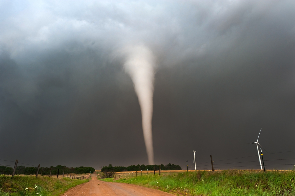
Throughout Monday, cities including Tulsa, Oklahoma City, and St. Louis are at a Level 3 enhanced risk on a five-point scale for severe storms, The Washington Post reports. Forecasts warn that damaging winds and tornadoes were a possibility in some areas.
“RELATED: Widespread Blackouts Predicted for 2024—Will They Hit Your Region?
The system will continue to push east through tomorrow.
The following day, the same system will progress towards the East Coast, bringing the potential for dangerous weather to the Tennessee and Ohio Valleys. According to Fox Weather, cities including Baltimore, Maryland; Charleston, West Virginia; Cincinnati, Ohio; Louisville, Kentucky; Nashville, Tennessee; and Washington, D.C. could experience intense wind damage and potentially large hail.
“We’re talking the size of baseballs,” Kendall Smith, a meteorologist for Fox Weather, said during an update. “I don’t know about you, but I certainly don’t want a baseball to come crashing down while I’m driving on the highway, or even just my home in general. So you need to take those precautions today and make sure that you are ready.”
The system could also generate tornadoes in some places Tuesday, especially in parts of Ohio, Tennessee, northern Alabama, and central Mississippi, CNN reports.
RELATED: How New “Extreme” Thunderstorms and Wind Are Increasing—And Affecting Where You Live.
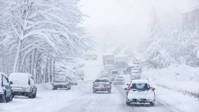
The storm is also expected to bring a hefty amount of snow to some places.

While regions to the south will see increased risk of flooding and extreme thunderstorms, others will be in for another blast of winter beginning Tuesday.
“Though severe weather may be what is garnering the most attention on the storm’s southern flank, the northern side should not be ignored,” Dan Pydynowski, an AccuWeather meteorologist, said in an update.
Forecasts show that parts of Wisconsin, Illinois, and Michigan could kick off April with fresh snow, AccuWeather reports. While Chicago may only get a wintry mix of rain and flakes, central Michigan could see six to 12 inches accumulate by tomorrow night. The storm will then shift east by Wednesday, where it could bring 12 to 24 inches to central New England in Vermont, New Hampshire, and Maine, as well as six to 12 inches to Upstate New York.
Depending on how the system progresses, this could also shift the focus to bring even more to lower New England. “Should the storm develop far enough south, the heaviest snowstorm of the season could occur in Boston,” Alex Sosnowski, senior meteorologist with AccuWeather, explained in a forecast update.
Chillier temperatures and more severe weather will persist later in the week.

Even after the snowflakes have stopped falling, much of the Northeast and Mid-Atlantic will still be experiencing a winter-like spring.
“Several days of cold winds will accompany and follow the storm that is likely to be a slow-mover,” Sosnowski said during a forecast. “It may seem like winter finally showed up.”
Meteorologists predict that many places could be five to 15 degrees colder than their seasonal averages through the rest of the week. Temperatures could also spur extra snow flurries in parts of the Northeast, AccuWeather reports.
The further southern reaches of the storm will also place the Mid-Atlantic coast at risk of severe thunderstorms on Wednesday evening. Forecasts warn that wind gusts of up to 60 miles per hour and torrential rain could hit from Washington, D.C., down through northern South Carolina.