Spring Blizzard Will Bring 12 Inches of Snow to These Regions
Spring weather can be notoriously full of surprises, bringing different conditions from one year to the next. And while we’re not yet even a full week into the season, this year is proving to be no different as chilly temperatures and severe storms have left many questioning whether winter has really moved on yet. Now, a spring blizzard is expected to bring 12 inches of snow or more to some parts of the U.S. this week. Read on to see which regions will be affected and what else is in store weather-wise.
RELATED: Signs Now Pointing to an “Explosive Hurricane Season” This Year, Scientists Warn.
Spring has felt much more like winter in its earliest days this year.

After a relatively mild winter, spring appears to be picking up the slack for many parts of the U.S., with some of the most significant winter-like storms marking the beginning of the season. Over the weekend, two combining systems helped generate significant snowfall across parts of the Northeast as they pushed into the area on Saturday.
Northern New England saw more than two feet of flakes in some places, with 28 inches recorded in the town of Albany, New Hampshire, and 27.3 falling in Ludlow, Vermont, Fox Weather reports. Parts of Maine and Upstate New York also recorded just short of two feet.
The storm also brought high winds and torrential rain, drenching the East Coast from Boston to the Washington, D.C. area. As of March 24, roughly 260,000 people were left without power as a result of the weather, The New York Times reported.
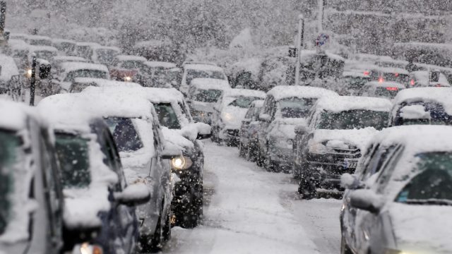
RELATED: Why You Should Never Use Your GPS During a Snowstorm, Officials Warn.
A spring blizzard will bring snow and wind to the Midwest and Northern Plains States through tomorrow.

But just as the combined storms began pulling out of the Northeast, a new snowy system emerged in another part of the U.S. On March 24, a major blizzard struck parts of the Midwest and Northern Plains States in the beginnings of a multiday push through the area, Fox Weather reports.
The storm developed after colder air from Canada combined with a moisture-heavy front pushing in from the Pacific. It dropped heavy snow on the Rockies before it snarled travel in Minnesota and Nebraska, reducing visibility and causing road closures. It also broke records in Minneapolis, dropping the most snow in the city since Jan. 4 and producing the most single-day accumulation for March since 2008, with 8.2 inches recorded.
And the storm isn’t finished yet: Blizzard warnings are still in effect for through Tuesday across parts of Colorado, Nebraska, and South Dakota. Winter storm warnings are also in effect in Minnesota and northern Wisconsin, while winter weather advisories are in place from northern Texas through the Plains States, Fox Weather reports.
The system is expected to affect a large area, with more than 500,000 square miles forecast to receive at least a few inches of snow before the middle of the week, AccuWeather reports.
RELATED: New Spring Forecast Shows Which U.S. Regions Will Be Warmer and Wetter This Year.
Some places could see the most snowfall of the season with this storm.

Forecasts show that the latest system isn’t done battering the region just yet. By the end of Tuesday, six to 12 inches is expected to accumulate across much of central Minnesota, South Dakota, North Dakota, and central Nebraska, per AccuWeather.
The heaviest-hit regions will likely be in western South Dakota and central northern Minnesota, where 12 to 18 inches could fall. Experts say the late-season push could be the most significant yet this year for some areas that otherwise saw much less of the white stuff than usual.
“This new storm could end up being the biggest single snowfall in the wintertime for parts of the Dakotas and Minnesota,” Brandon Buckingham, a meteorologist with AccuWeather, said during a forecast.
While it’s still expected to see less accumulation overall, the forecast also warned that areas on the fringes of the storm could see wetter, heavier flakes along with strong wind gusts. This could set up some places for power outages as weighed-down tree branches fall.
Severe weather and flooding, including tornadoes and hail, could also follow the blizzard.

Even after it stops dropping heavy snow, the system could have a significant impact on weather throughout the week. On Tuesday, it’s expected to produce severe thunderstorms and heavy rain across parts of Illinois, Michigan, Indiana, and Ohio, with gusts of up to 60 miles per hour and the potential for isolated tornadoes, according to AccuWeather.
The far-reaching system could also bring bad weather to areas much further south. Forecasts say the front could generate severe thunderstorms across the Gulf Coast and inland Alabama, bringing damaging wind gusts up to 65 miles per hour and heavy downpours. By Wednesday evening, this will push farther east to include northern Florida, eastern Georgia, and the southern tip of South Carolina.