This Week’s “Severe Weather” Could Bring Tornadoes and Hail to These Regions

Now that March has arrived along with some unseasonably warm weather, many are getting ready to pack away their heavy coats and sweaters for the return of spring. But the change in seasons also means other types of extreme events will soon replace the blizzards and temperature drops brought on by the polar vortex. Now, parts of the U.S. are forecasted to see “severe weather” this week—possibly including hail and tornadoes. Read on to see which regions will be affected and how conditions could play out before the weekend.
RELATED: “Remarkable” Polar Vortex Disruptions Could Send Temps Plummeting Again—Here’s When.
Much of the U.S. saw temperatures rise well above their averages in the past few days.

This year, March kicked off with a surprise, as many areas were treated to an early taste of spring weather. After initial predictions put more than 300 cities within reach of breaking records, large swaths of the U.S. saw temperatures jump well above their seasonal averages, with cities including New York and Chicago reaching as high as 65 and 71 degrees, respectively, the Daily News reports.
Much of the weather was expected to stick around through Monday. According to an AccuWeather forecast, a large area covering the Great Plains and Mississippi Valley could see temperatures shoot 15 to 30 degrees above their averages for the beginning of March. However, the sudden warm-up might be short-lived for some—and could even bring some serious storms in its wake.
RELATED: “Very Active” Hurricane Season Expected This Year—Here’s Where.
Severe weather could strike this week on the heels of the warmth spike.

Unfortunately, the pleasant warmth of the weekend might be a fleeting experience, depending on where you live. Beginning on Monday, the National Oceanic and Atmospheric Administration’s (NOAA) Storm Prediction Center (SPC) warned that large parts of the U.S. could be in for severe weather throughout the week.
While everyone appreciates a pleasant break from the chilliness of winter, experts point out that such anomalies can also have stormy consequences.
“Many times when there is a cold front or zone of low pressure moving into a region with record (or near-record) warmth, it raises concern for severe weather,” Adam Douty, a senior meteorologist with AccuWeather, explained in a forecast.
RELATED: New Spring Forecast Shows Which U.S. Regions Will Be Warmer and Wetter This Year.
Thunderstorms could sweep across some regions, possibly bringing damaging hail and tornadoes.
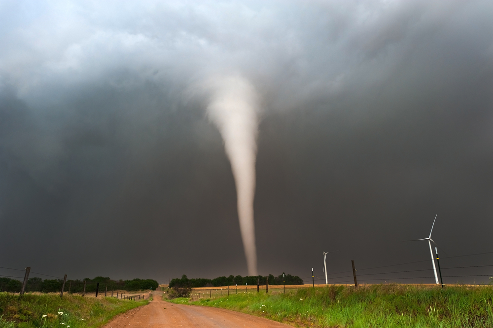
The earliest part of the week could see large sections of the U.S. affected by extreme conditions. An area stretching from Wisconsin and Indiana down through Texas and Mississippi is in line for severe thunderstorms, bringing the potential for hail, strong winds, and tornadoes, AccuWeather reports. Major cities in the affected region include Chicago, Indianapolis, St. Louis, Dallas, Houston, and New Orleans.
By Tuesday, the brunt of the system in the south is expected to shift slightly east to cover Arkansas, Louisiana, eastern Texas, and western Mississippi with potential severe storm threats, Fox Weather forecasts. It carries over to southern Florida for Wednesday, including cities like Tampa and Miami.
The extreme weather is also expected to bring potential flash flooding as it makes its way across the Southeast. According to NOAA, the risk is most significant today in southern Louisiana, but tomorrow poses a possible risk for most of Mississippi and Georgia, all of Alabama, and the Florida Panhandle.
The wet weather could carry on later in the week and bring flash flooding to some places.

By the middle of this week, the wet conditions are expected to continue to push towards the coast. And while it’s not likely to create the same thunderstorms or tornadoes there, the Northeast and Mid-Atlantic could see a decent amount of rainfall.
Beginning on Wednesday, the storms are expected to reach coastal regions from southern New England down through the Delmarva Penninsula, according to Fox Weather. Southern areas should expect to see up to two to three inches of rain through Thursday, while the northern end could see as much as three to five inches, creating a risk of flash flooding.