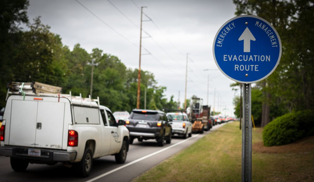
“Very Active” Hurricane Season Expected This Year—Here’s Where

Having an idea of what’s coming in terms of severe weather is always a good thing, but it’s especially important when it comes to hurricane season. That’s why meteorologists analyze conditions and sort through data to put up long-range forecasts and try to get a better idea of how intense a particular year might be. But while outlooks can change, there’s now more evidence to expect a “very active” hurricane season this year. Read on to see what the data says and which parts of the U.S. could be most affected.
RELATED: New Spring Forecast Shows Which U.S. Regions Will Be Warmer and Wetter This Year.
Current El Niño conditions usually suppress hurricane formation.

“El Niño” has become one of the more recognizable weather terms, thanks to its periodic reappearance in headlines and forecasts. The phenomenon returns every two to seven years when warmer-than-average ocean surface temperatures develop in the Pacific off the coast of South America, according to the National Oceanic and Atmospheric Administration (NOAA).
Most people know El Niño because of the weather it tends to cause in the U.S. Typically, this means wetter, rainier weather in the South and Southeast and warmer, drier weather in the Northeast as the Pacific jet stream gets pulled farther south.
But many may not realize that it also keeps some other types of weather at bay, including hurricanes. And while current conditions might suggest a calmer year for Atlantic storms, there may be a drastic change on the horizon.
RELATED: “Extended Winter” May Keep Things Cold in These Regions, Meteorologists Predict.
Long-range forecasts predict La Niña conditions to replace El Niño this summer.
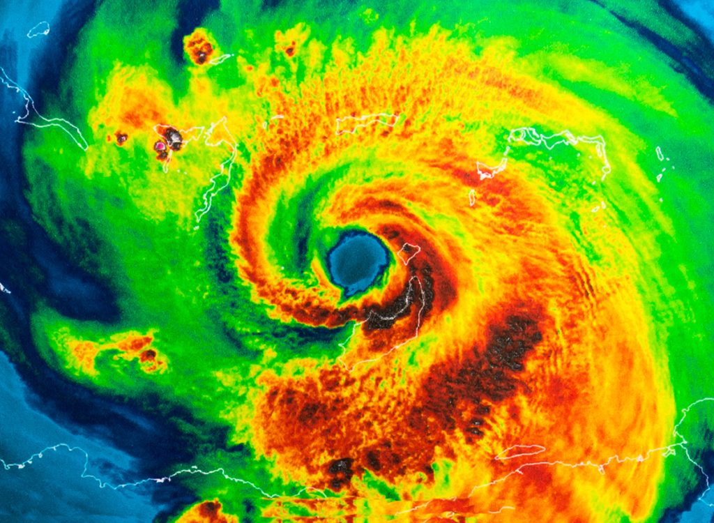
Meteorologists are now beginning to sound the alarm that 2024 could be a harder year for hurricanes. The first bit of evidence involves a drastic shift in the Pacific, with La Niña conditions—or colder ocean surface temperatures—replacing El Niño sometime around the second half of hurricane season this summer, AccuWeather reports.
“The second half of the hurricane season is likely to be very active, as conditions will be more favorable for tropical systems,” Paul Pastelok, a long-range weather expert with AccuWeather, predicted.
Historic evidence shows that these conditions can ramp up storm formation in the Atlantic. The most active seasons in history occurred in 2005 and 2020, both times when La Niña was quickly forming and when it was already in place, per AccuWeather.
RELATED: Live in These 10 Places? You’re Most at Risk for “Extreme Winter Weather”.
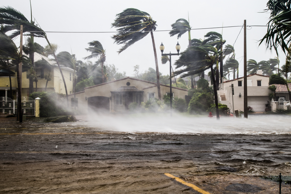
Warmer Atlantic Ocean temperatures could make matters even worse.
While colder waters in the Pacific help spur more dangerous storms, another set of conditions in the Atlantic might also fuel them at the same time. Data shows that ocean temperatures in the Atlantic hurricane basin are already at levels seen in July, AccuWeather reports.
Meteorologists say these readings are only expected to rise as air temperature goes up during the warmer months, providing more fuel to produce both stronger and more numerous hurricanes. Such conditions could also allow hurricanes to continue to pick up strength until right before they reach land, increasing the likelihood of them being destructive.
Unfortunately, this could put certain areas of the U.S. in a particularly precarious position during hurricane season.
“We expect that the Gulf Coast, especially the Texas coast, will be at a higher risk for direct impacts from a tropical system this year,” Pastelok warned.
Patterns could still change—or the season could start early.
Because of the warmer temperatures in the Atlantic, long-range forecasts are also warning that storms could start developing and arriving before the official start of hurricane season on June 1. According to AccuWeather, this has happened seven times during the past decade.
However, some meteorologists also point out that incoming information could still mean a change in the outlook.
“Of course, there is still some uncertainty in the sea surface temperatures,” Adam Lea, PhD, a climate physicist at TropicalStormRisk.com, said during an interview with Fox Weather on Jan. 29. “I mean, it’s not to say that something might happen or change rapidly in the atmosphere that might act to cool sea surface temperatures. You can’t rule that out completely.”
However, he still emphasized how evidence this year was already stacking up: “At the moment, it’s more likely than not that the sea surface temperatures in the tropical Atlantic will be warmer than average. Maybe not as warm as they have been recently, but still warmer than average.”