Post-Holiday Storms Bringing Rain, Snow, and Ice—Here’s What to Expect

If you’re getting ready to travel back home from your Christmas celebrations, you may need to take the weather into account. The National Weather Service’s (NWS) post-holiday forecast from its Weather Prediction Center indicates that several parts of the U.S. will experience troublesome winter conditions during this time—with rain, snow, and ice expected. In fact, a storm system currently moving east across the country is likely to cause delays and difficulties for millions returning home after the holidays, NBC News reported. To find out what the post-holiday storms have in store for your area, read on.
RELATED: A “Polar Vortex” Is Expected to Hit the U.S. Soon—Here’s What to Know.
The central and northern Plains have already been hit hard.
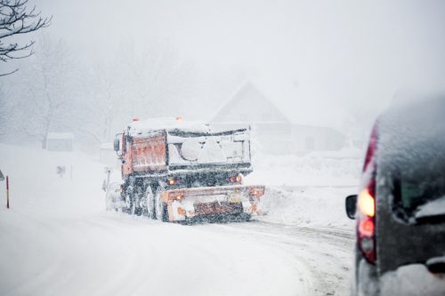
The center of the country faced the worst winter weather this Christmas. From the beginning of the week through early Wednesday, a “significant winter storm with heavy snow, blizzard conditions, and potentially damaging icing” took place across parts of the north-central U.S., according to an earlier NWS forecast.
During this storm, several cities were hit with significant snowfall, NBC News reported. The highest totals were recorded in Spearfish, South Dakota with 14.6 inches; Chadron, Nebraska with 13 inches; and Bird City, Kansas with more than 8 inches. Several areas in Colorado also saw more than a foot of snow due to the storm.
RELATED: 10 Ways to Prepare Your Home for a Snowstorm, According to Experts.
This storm is moving toward the Midwest now.

The same storm that brought blizzard conditions to the north-central U.S. is slowly moving east, NBC News reported. Today, the system is expected to bring light rain and snow showers to parts of the Midwest, the Great Lakes, and the Ohio River Valley. But it isn’t expected to be as strong as it was earlier this week.
“Some wrap-around moisture from the Great Lakes is forecast to rotate southward into the Midwest to provide mixed rain and wet snow today before tapering off this evening,” the NWS said in its Dec. 28 forecast. “Some heavier, but brief, snowfall may occur within this area of precipitation. Nevertheless, only minor snow accumulations are expected due to temperatures hovering just above freezing.”
RELATED: Weather Predictions Keep Changing—What the Unpredictable Shifts Mean for You.
The East Coast is dealing with heavy rain.
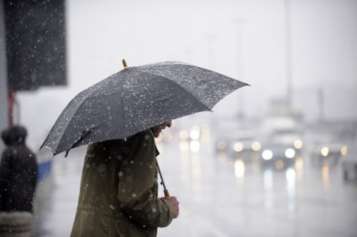
Meanwhile, a separate storm system that developed in the Southeast earlier this week is moving up the East Coast right now, according to NBC News. In its Dec. 28 forecast, the NWS said that this “strengthening coastal low tracking” is now spreading moderate to heavy rain across the northern Mid-Atlantic states into southern New England.
“The heavy rain may produce excessive runoff, resulting in the flooding of rivers, creeks, streams, and other low-lying and flood-prone locations,” the NWS warned. “Onshore winds along with astronomical high tide are expected to produce minor coastal flooding along vulnerable waterfront and shoreline areas in the New York City metro into this morning.”
The agency also said that “on-and-off rain showers” are expected to linger across most of the Northeast, with a possible shift to light wet snow over Maine on Dec. 29.
“Light wet snow is expected to linger along the Appalachians as well,” the NWS added.
The West Coast will likely see the same soon.
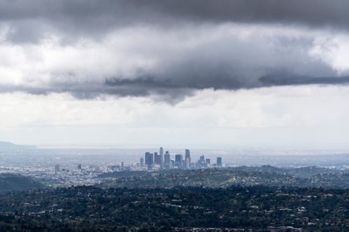
The West Coast won’t be getting off easy either: A series of storms is expected to push into the region this weekend and bring heavier rain that way, The Washington Post reported.
According to the newspaper, periods of precipitation are forecast to hit the Pacific Northwest coastline southward along Interstate 5 to San Francisco by late Dec. 29, before moving south through the rest of California into Dec. 30.
“Moisture well ahead of a couple of large Pacific cyclones is forecast to produce unsettled weather along the West Coast for the next couple of days,” the NWS shared. “These systems will generate rain and high elevation snow over the Pacific Northwest and California, while much of the reminder of the western U.S. is forecast to remain dry. Mixed precipitation is forecast to reach into the Great Basin by Saturday morning.”
RELATED: For more up-to-date information, sign up for our daily newsletter.