These Are the Best Road Trips in New England
No region in America crackles with more history than New England, home to stunning states like New Hampshire, Maine, Massachusetts, and Connecticut. And there’s no better way to tour the birthplace of the revolution and experience its unique character and beauty—the kaleidoscopic foliage, the centuries-old settlements, the idyllic lighthouses—than from the seat of your car.
Sure, while New England may be at its most popular during fall’s colorful leaf-peeping season, it’s more than worthy of a year-round excursion. So whether you’re looking to see the serene summer shoreline in Cape Cod or the winter wonderland of New Hampshire’s White Mountains, know that there’s a New England road trip for you. And if you want even more great trip ideas, don’t miss the 40 Roads Everyone Should Drive by Age 40.
1
Mohawk Trail, Massachusetts

Start: Athol, Massachusetts
End: Williamstown, Massachusetts
Distance: 63 miles
Massachusetts’ Mohawk Trail once served as a trade route that connected Native American tribes along the Atlantic coast. Today, however, the 63-mile corridor—which runs from Athol to Williamstown—is frequented by travelers eager to explore New England’s storybook villages, tranquil streams, and, come October, fiery foliage.
The modern-day trail follows Routes 2 and 2A along the Deerfield River and over the Connecticut River, affording motorists picturesque glimpses of the Berkshires and the Taconic Mountains. Pro tip: While it’s hard to take your eyes off the leafy landscapes of Massachusetts, be sure to watch out for the harrowing Hairpin Turn (pictured above), which rises sharply on the western side of the Whitcomb Summit in the northwestern corner of the state.
2
Coastal Byway, New Hampshire
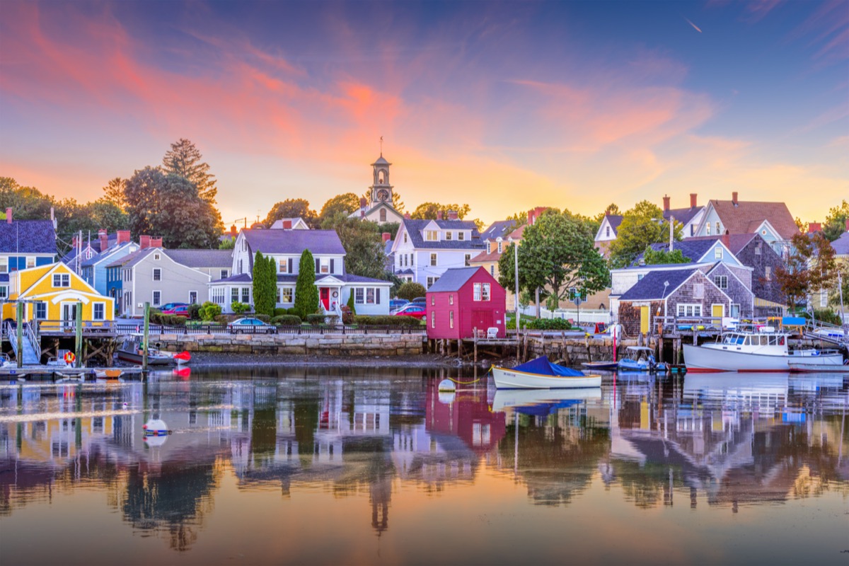
Start: Seabrook, New Hampshire
End: Portsmouth, New Hampshire
Distance: 22 miles
As one of the smallest states in America—both in terms of population and square miles—it’s only fitting that New Hampshire also has the country’s shortest coast.
Boasting a mere 18.5 miles of Atlantic shoreline, it makes the most of it with its own Coastal Byway. The track passes state parks, sandy beaches, and elegant mansions, which are spread out between Portsmouth, New Castle, Rye, North Hampton, Hampton, and Seabrook. And for more detour destinations, check out The 33 Best Roadside Attractions in America.
3
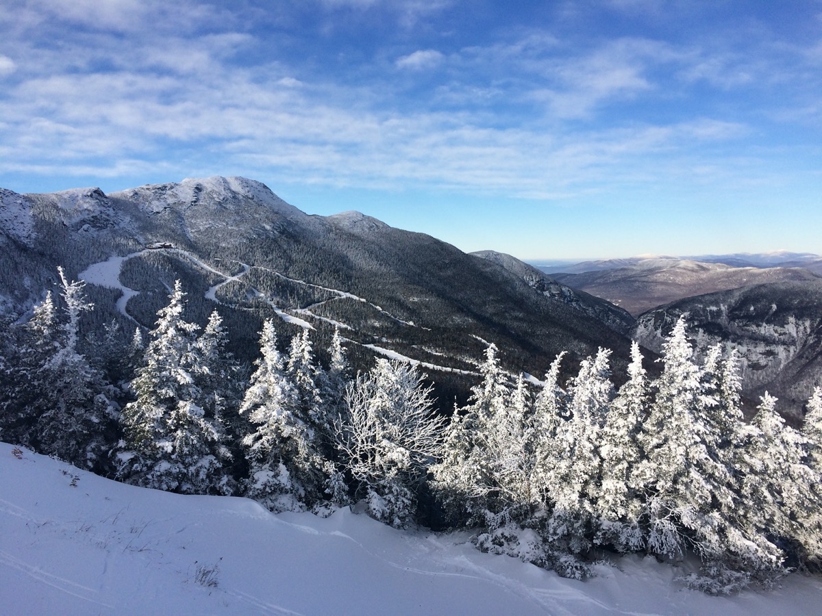
Kancamagus Highway, New Hampshire
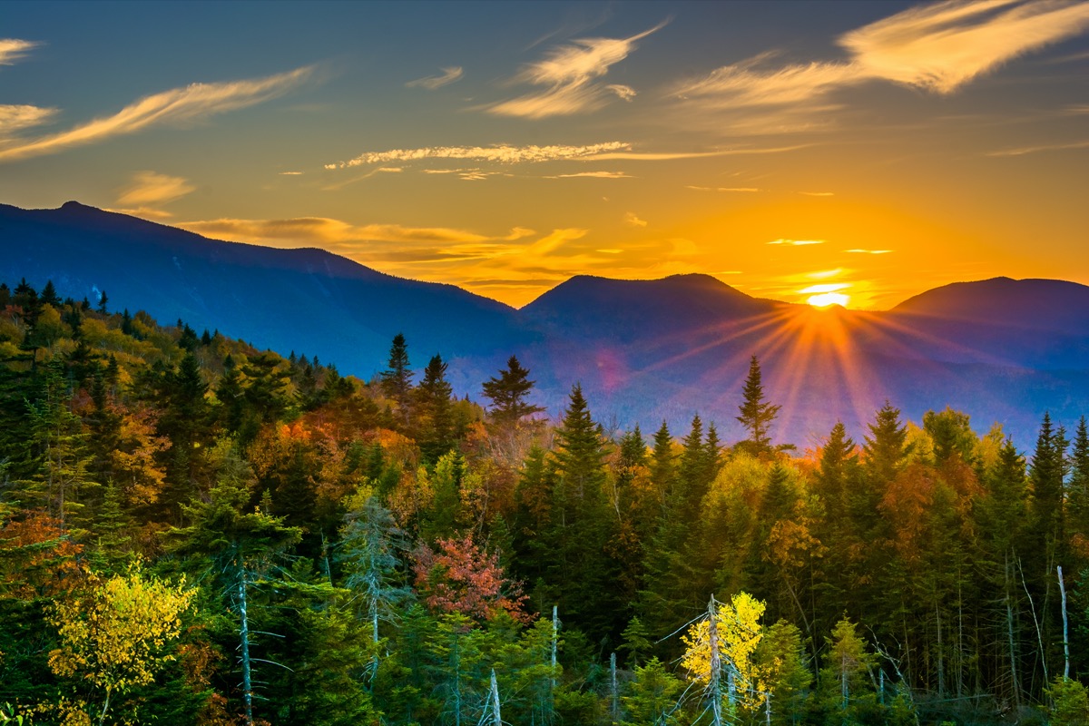
Start: Lincoln, New Hampshire
End: Conway, New Hampshire
Distance: 34.5 miles
The ‘Kanc,’ as it’s known locally, snakes for 34.5 miles through New Hampshire’s backcountry. Following Route 112 from Lincoln to Conway, the two-lane highway is blissfully free of restaurants, gas stations, hotels, and stores. Instead, what you’ll see—from both your car window and scenic sites—are the rugged White Mountains, the boulder-strewn Pemigewasset River, the cascading waters of Sabbaday Falls, and numerous national forest campgrounds. If you’re patient (and ultra-observant), it’s not uncommon to run into eagles, deer, bears, or moose.
4
Connecticut Coast Scenic Drive, Connecticut
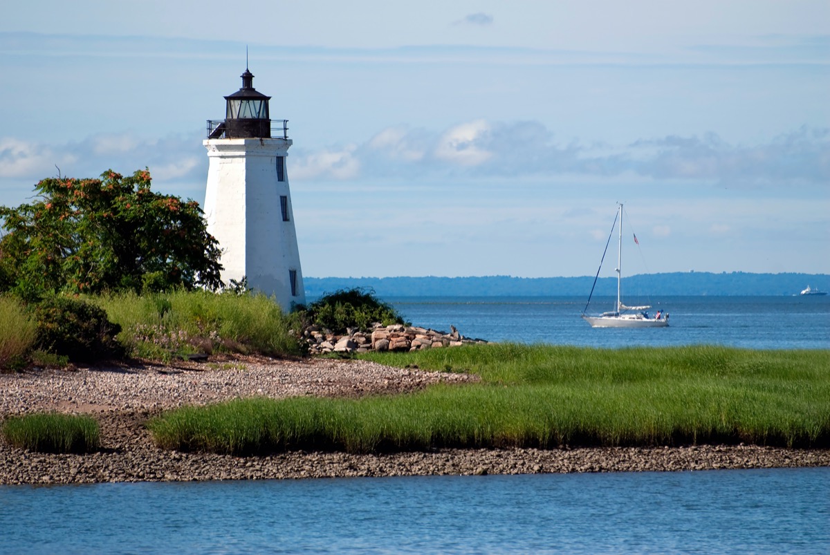
Start: Stonington, Connecticut
End: Greenwich, Connecticut
Distance: 110 miles
There are a few different ways one can explore Connecticut’s Long Island Sound, but if you’re down to see all 110 miles, the drive from Stonington to Greenwich is what you’re after. The coastal circuit shows off the state’s salt marshes, beaches, and postcard-perfect lighthouses. You’ll also cruise through New England’s oldest villages which charm—Gilmore Girls-style—with tree-lined streets and colonial homes.
5
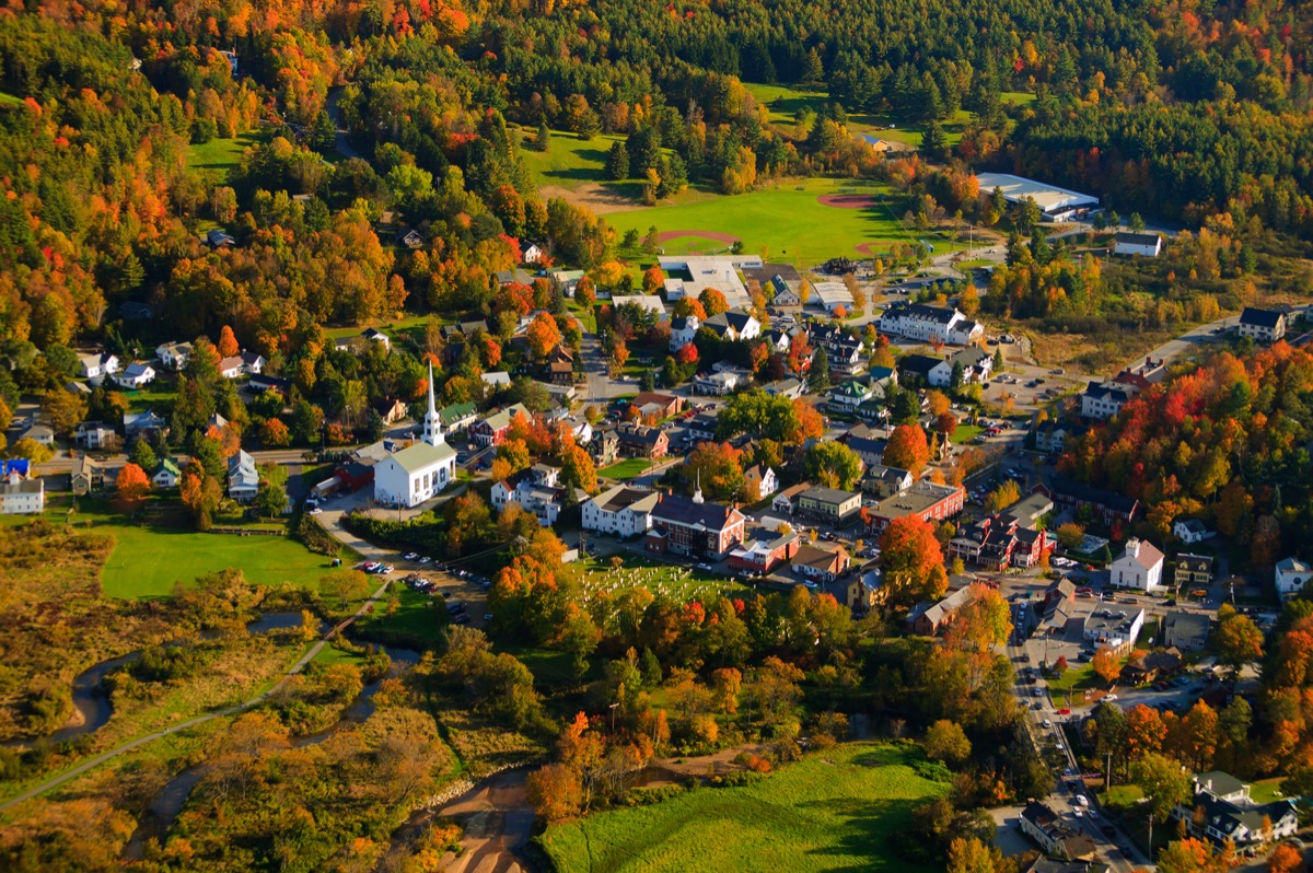
Route 100, Vermont
Start: Troy, Vermont
End: Whitingham, Vermont
Distance: 217 miles
Route 100 is a highlight reel of everything Vermont has to offer. The 217-mile road runs through the center of the state following the eastern edge of the Green Mountains, from its Canadian border to its Massachusetts border. Known as “Vermont’s Main Street” and “The Skier’s Highway,” Route 100 features direct access to some of the state’s premier resort towns including Stowe, Killington, and Wilmington, as well as the most well-known ski slopes (Okemo, Sugarbush, and Mad River Glen, among others).
6
Green Mountain Byway, Vermont
Start: Cambridge, Vermont
End: Waterbury, Vermont
Distance: 88 miles
A few years ago, Vermont’s Green Mountain Byway spanned 11 miles from centrally-located Waterbury to northern Stowe in the state’s ski country. But an expansion in 2018 added 71 more miles to include the idyllic hamlets of Morristown, Hyde Park, Johnson, and Cambridge. The byway is best during peak fall foliage, as it unfolds across three state parks—Little River, Smugglers’ Notch, and Waterbury Center—and meanders through private farmland, sprawling meadows, and white chapel-flecked villages.
7
Park Loop Road, Maine

Start: Bar Harbor, Maine
End: Bar Harbor, Maine
Distance: 27 miles
New England lays claim to just one national park (and an A+ one at that), so we’d be remiss not to suggest a drive around Acadia. Park Loop Road, which was partially financed by John D. Rockefeller, Jr., rambles for 27 miles around Mount Desert Island. The easiest place to start is the Hulls Cove Visitor Center in Bar Harbor. From there, you’ll notice several pull-off points, including Sand Beach, Thunder Hole, and Otter Cliff, which allow you to stop and photograph the park’s mountains, forests, and rocky shores.
8
Rangeley Lakes Scenic Byway, Maine
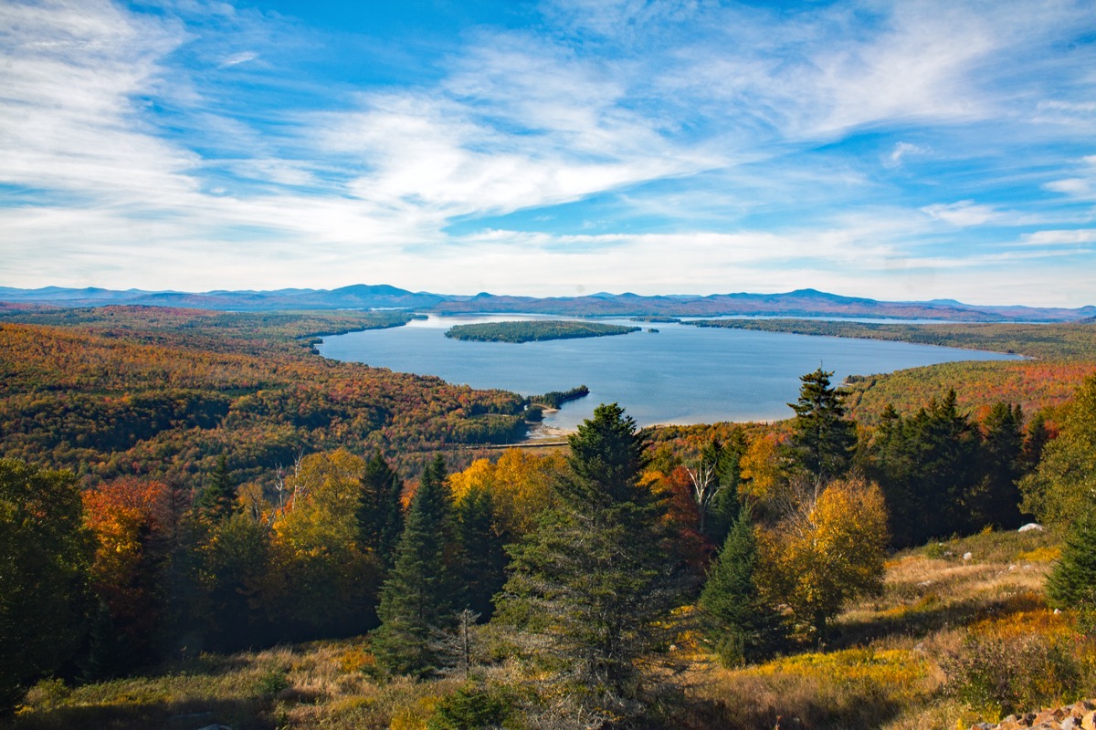
Start: Madrid, Maine
End: Houghton, Maine
Distance: 52 miles
It only takes a few hours to drive Maine’s Rangeley Lakes Scenic Byway, but we recommend going slow and giving yourself the whole day to explore. The 52-mile course, which follows Routes 4 and 17, coasts along the Appalachian Mountains ridgeline, delivering spellbinding tableaus of Toothaker Island, Saddleback Mountain, Upper Richardson lake, and more than 100 other interconnected bodies of water. Ask a local where to catch prime views, and they’ll point you to the Height of Land, where you’ll find Maine’s jewel-blue Mooselookmeguntic Lake, framed by New Hampshire’s looming White Mountains.
9
Blackstone River Valley Corridor, Rhode Island
Start: Worchester, Massachusetts
End: Pawtucket, Rhode Island
Distance: 46 miles
Rhode Island’s Blackstone River Valley Corridor takes visitors back in time to the American Industrial Revolution. The historic passage comprises 24 mill towns and villages (settled as early as 1661), which hug the Blackstone River between Worchester, Massachusetts and Pawtucket, Rhode Island. Along the 46-mile route you’ll encounter quintessential country stores, wooden one-room schoolhouses, hilltop apple orchards, Colonial-era mansions, and some of the country’s longest continually operating textile mills.
10
Old King’s Highway, Massachusetts
Start: Sandwich, Massachusetts
End: Orleans, Massachusetts
Distance: 34 miles
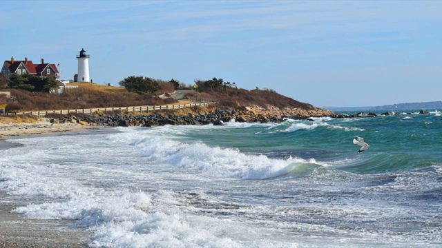
History buffs will want to pay special attention to this trip as its winds through a handful of the country’s oldest villages (think: Sandwich, Yarmouth, Barnstable, Brewster, and more). Following Route 6A along the bay side of Cape Cod, Old King’s Highway wows with a panorama of pilgrim churches, sea captains’ saltbox houses, pre-Colonial burial grounds, tidal flats, and pristine Atlantic beaches.
11
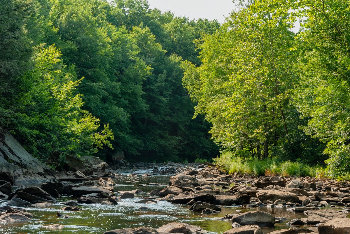
Jacob’s Ladder Scenic Byway, Massachusetts
Start: Lee, Massachusetts
End: Westfield, Massachusetts
Distance: 35 miles
The road that is now Jacob’s Ladder Scenic Byway opened in 1910, debuting as the country’s first highway for “horseless carriages” (read: early automobiles). While it was originally a popular way to get from Boston’s suburbs to the Connecticut and Hudson River valleys, it was eventually outpaced by the Massachusetts Turnpike, which runs roughly parallel. Today, the 35-mile stretch follows the southern Berkshires, with sweeping vistas of Tekoa Mountain and Laurel Lake.
12
Lakes Region Scenic Byway, New Hampshire
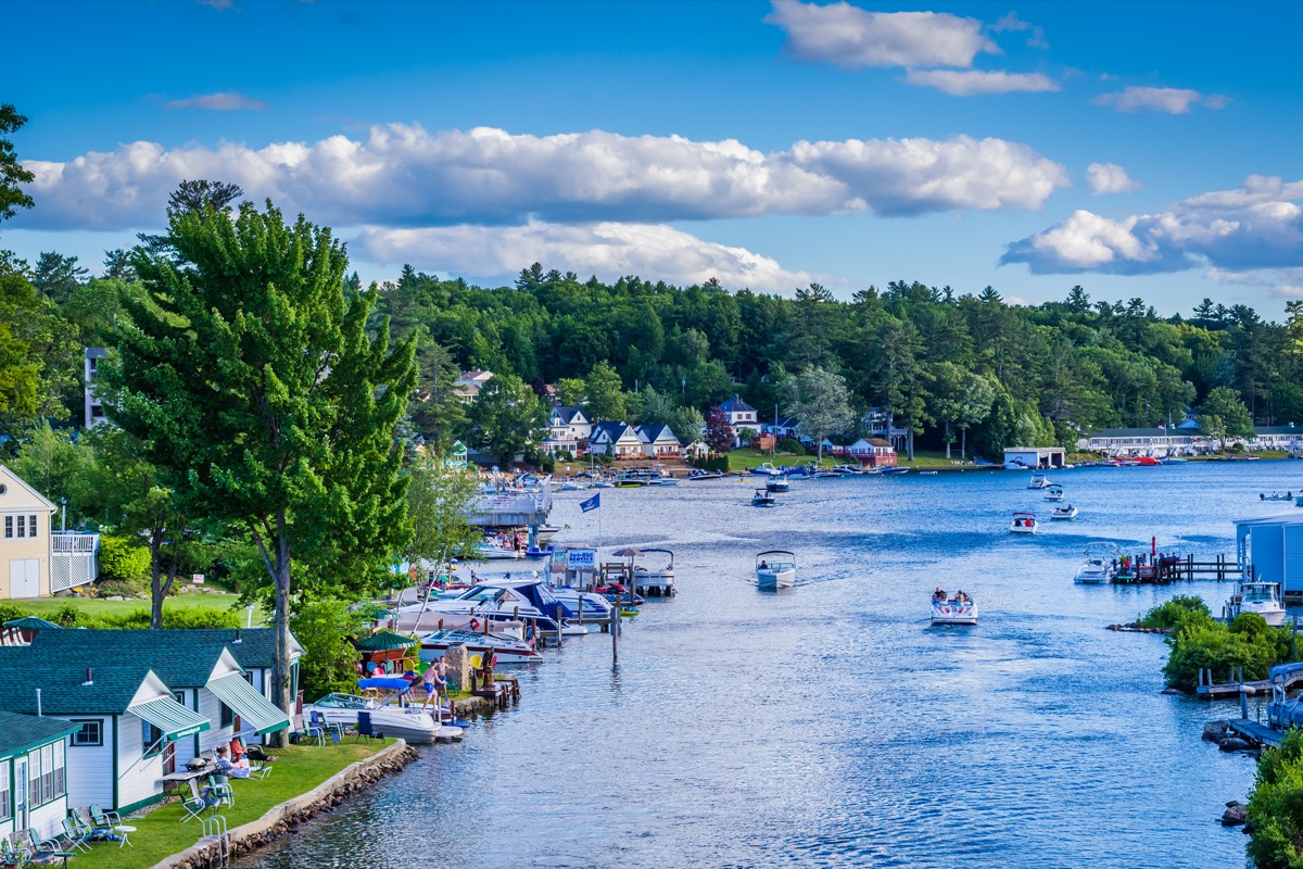
Start: Alton, New Hampshire
End: Wolfeboro, New Hampshire
Distance: 97 miles
If you thought the White Mountains were New Hampshire’s one claim to fame, think again. The Lakes Region, in the east-central part of the state, has attracted the likes of politicians and celebs, from Drew Barrymore to Jimmy Fallon, who even named his daughter, Winnie, after Lake Winnipesaukee. This 97-mile byway circumnavigates the state’s largest lake and offers views of the Ossipee Range all the while.
13
The Last Green Valley National Heritage Corridor, Connecticut
Start: Norwich, Connecticut
End: Brookfield, Massachusetts
Distance: 120 miles
Hoping to check out more than a few New England towns? The Last Green Valley encompasses 35 villages between northeastern Connecticut—AKA the state’s ‘Quiet Corner’—and south-central Massachusetts. Named for its breadth of farmland and forest (think: 695,000 acres of unspoiled nature), the path is also known for being the darkest area between Boston and Washington, D.C. come nightfall. You’ll have no trouble finding excursions as you pass by hiking, biking, and walking trails as well as Old Sturbridge Village: New England’s largest living museum, which shows what early 19th-century life was like.